Updates

What I have built into Linje since 7 September 2026, as stops on a ride. Tap a stop to see what changed and why.

The route so far

10 updates so far, the newest on 21 October 2026. The route is a real Linje loop from Røa, in Oslo. Every screen is the app as it is today.

Every update, newest first

Update 10 of 10,

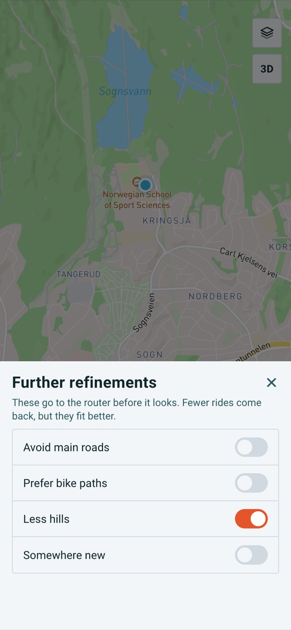
Less hills, and a second look

Flatter rides when you ask for them, more rides from a short search, and better photographs of places.

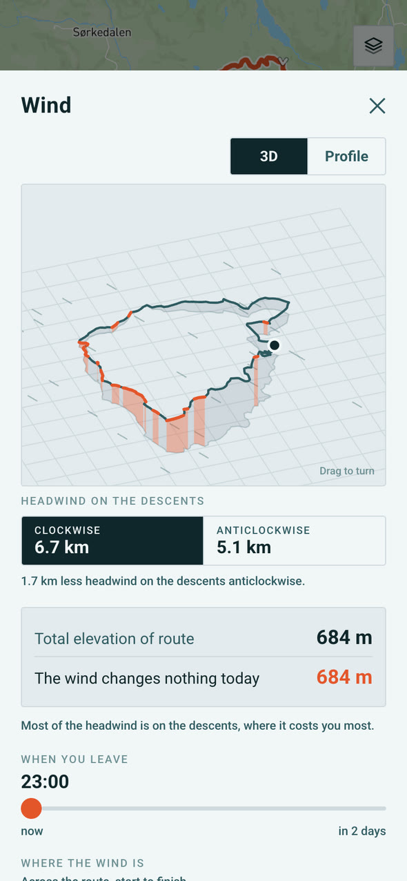
Further refinements in Linje at Sognsvann: Avoid main roads, Prefer bike paths, Less hills switched on, and Somewhere new

What changed

  • Less hills: turn it on and the first card climbs a fifth to a third less per kilometre on three of the four rides I measured.
  • When a search finds only one or two rides, Linje goes back for more. It helps most among mountains and fjords, where a loop is hardest to fit.
  • A place's photograph is now of the place itself and in colour, or there is no photograph.

Why

One ride isn't a choice, so I go back for more, even among the fjords. And I'd rather show you no photograph than the wrong one.

How it went

  1. Less hills, measured against the real router
  2. A second wave of searching
  3. Better photographs of places

Tell me what you think

Update 9 of 10,

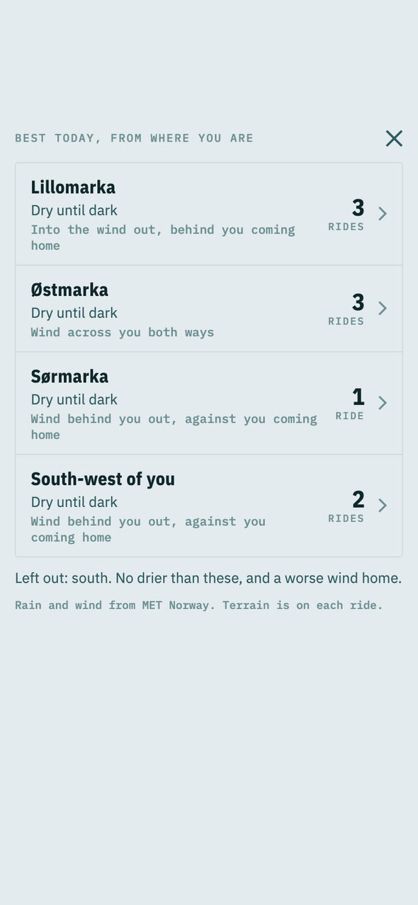
Best today, and snow you can act on

Rides from where you are, grouped by where conditions are best, and snow you can ride round.

Best today, from where you are: Lillomarka, Østmarka, Sørmarka and South-west of you, each dry until dark
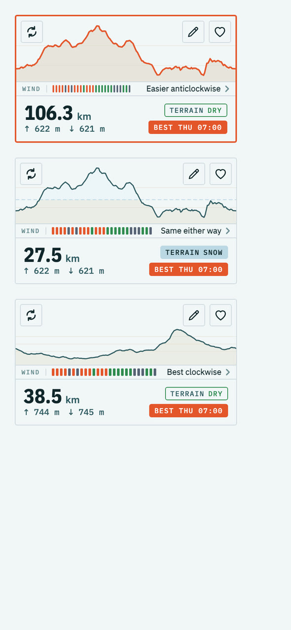
Three route cards, one marked Terrain snow

What changed

  • Best today: rides from where you are, grouped by the direction with the best conditions today.
  • Snow you can act on, in Norway: where the snow is on a ride, whether it is coming or going, and a version of the ride off it.
  • Less hills: a switch for flatter rides.
  • A sweep across the map while a search runs, showing how far the ride can reach.

Why

With autumn the question changed from where to ride to whether, and where it is still good. Best today answers that, and the snow work is for the weeks either side of winter.

How it went

  1. Best today
  2. Snow, and a way round it
  3. Less hills
  4. The search sweep
  5. Fixes found on my phone at Sjusjøen

Tell me what you think

Update 8 of 10,

A redesign, ride invites and an editor

A new planner and route card, a way to ask friends along, and a way to change a ride.

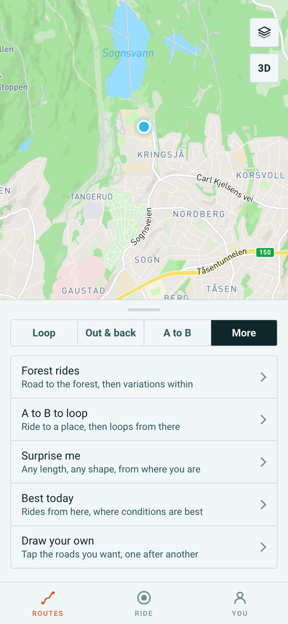
The planner's More menu: Forest rides, A to B to loop, Surprise me, Best today and Draw your own
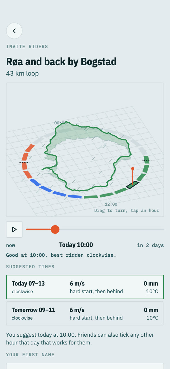
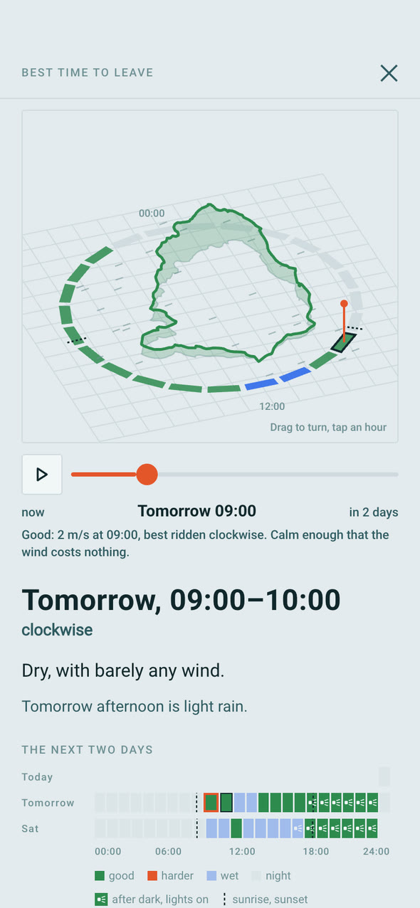
Inviting riders: the route, the best-time graph and the suggested times

What changed

  • A redesign of the planner and the route card: a verdict on every card, saved routes under You, and More for the kinds of ride that are not a shape.
  • Ride invites: send a route and a day, and friends tick the hours they can make in a browser, with no app needed.
  • A route editor: Trim takes a stretch out and lets you join the gap, and Draw makes your own by tapping roads.

Why

I tried the redesign as a separate app on my phone first, and kept it. Invites and the editor are what a ride needs once there is more than one person, or more than one opinion, about it.

How it went

  1. The redesign, tried as its own app on my phone
  2. It became the app
  3. Ride invites
  4. The route editor, Trim and Draw

Tell me what you think

Update 7 of 10,

The first real ride

The first real ride with the app, and what it found.

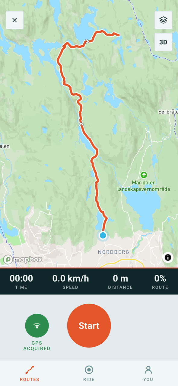
Linje's record screen before a ride: time, speed, distance and Start

What changed

  • A ride summary that sets the route you planned beside the route you rode, with speed and elevation graphs.
  • Four fixes for the battery.
  • Soft foot trails now count as paths for walkers, and generated loops keep their corners off them.
  • A green line for the part of the ride already done.

Why

Planning a ride on a screen and riding it are different tests. This was the first real ride with it, and these are the things the ride found.

How it went

  1. The first real ride
  2. The ride summary, the battery and the trail fix

Tell me what you think

Update 6 of 10,

Surprise me, and the ride stood up

A mixed batch of rides from where you stand, A to B to loop, and the ride drawn on its hills.

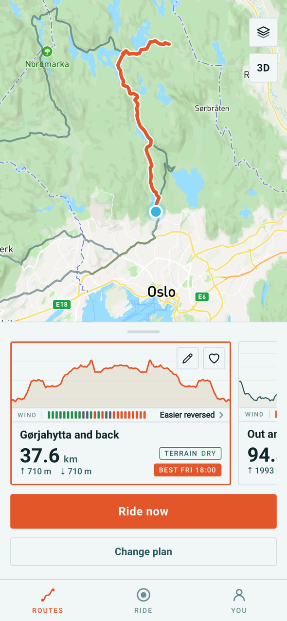
Surprise me's first ride: Gørjahytta and back, 37.6 km, to a named cabin
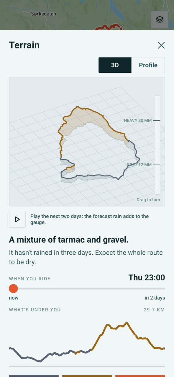
The terrain page's ride graph: the ride in 3D, painted by surface, with the rain gauge

What changed

  • Surprise me: a mixed batch of rides from where you are standing, a loop, an out and back and one to a named cabin.
  • A to B to loop: ride to a place, choose a loop from there, and come home the way you came.
  • The ride graph: the ride stood up on its hills at the top of the wind, terrain and best time pages.

Why

Sometimes you know where you want to go and sometimes you just want to ride. And kilometres of headwind mean more when you can see where they are.

How it went

  1. Surprise me, and A to B to loop
  2. The ride graph on the weather pages

Tell me what you think

Update 5 of 10,

Into the forest, offline maps and GPX

Rides that stay in the forest, maps that work without signal, and GPX in and out.

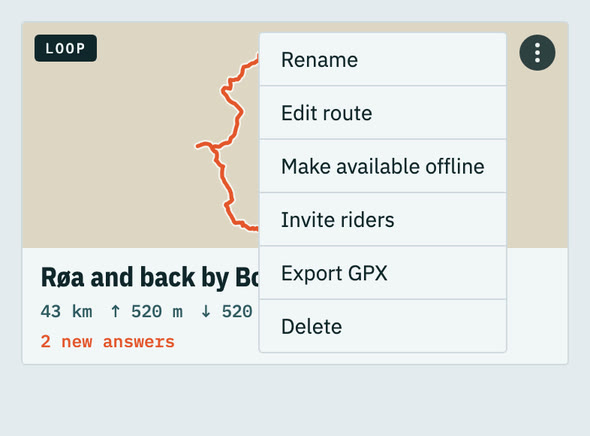
A saved route's menu: Rename, Edit route, Make available offline, Invite riders, Export GPX and Delete

What changed

  • Rides that stay in the forest: choose where to go in, and Linje builds loops from there, with the road in and the road home.
  • Offline maps for saved routes, for when there is no signal.
  • GPX import, matched to the roads, and GPX export for a bike computer.

Why

Most of the good gravel near Oslo is in the marka, and a ride that leaves it after a kilometre is not the ride anyone wanted. Offline maps and GPX are what a rider expects before trusting an app with a long day out.

How it went

  1. Rides in the forest, with a choice of where to go in
  2. Offline maps for saved routes
  3. GPX import and export, both working on my phone

Tell me what you think

Update 3 of 10,

It became Linje

A new name and a set of badges.

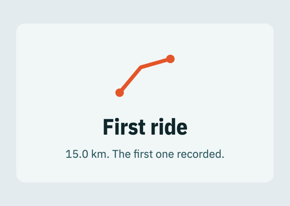
A badge card: First ride, 15.0 km, the first one recorded

What changed

  • The app was called FeilVei until now. It became Linje, Norwegian for line.
  • Badges for distance, climbing, speed, riding often, exploring and the weather you rode in.

Why

FeilVei means wrong way, which is a poor name for something that plans routes. Linje is what it draws: one line on a map, one ride. The badges are there because a finished ride should leave you something to keep.

How it went

  1. Renamed Linje
  2. The badges

Tell me what you think

Update 2 of 10,

The wind and the terrain

Every route started telling you about the wind on it, and what the rain has done to the gravel.

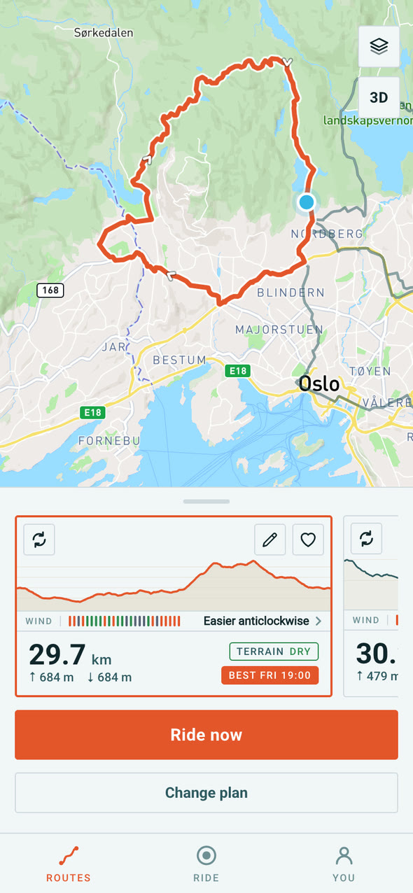
A 29.7 km loop from Sognsvann on its route card: the wind bar, Easier anticlockwise, Terrain dry and the best time to leave

What changed

  • A wind bar under every route: orange where it is against you, green where it is behind.
  • Which way round: the direction that keeps the headwind off the descents.
  • The terrain check: one word for the gravel, dry, wet, soft, frozen or snow, from NVE's rain and snow records.
  • Rides can be saved for a day, with the forecast for that day.

Why

Other planners stop at the route. The weather is what decides whether a ride is any good, so it had to sit on the route itself.

How it went

  1. Wind on every route, and which way round
  2. The terrain check, read from NVE
  3. Rides saved for a day

Tell me what you think

Update 1 of 10,

Where it started

A way to record a ride, a map to plan one on, rides to a cabin and A to B.

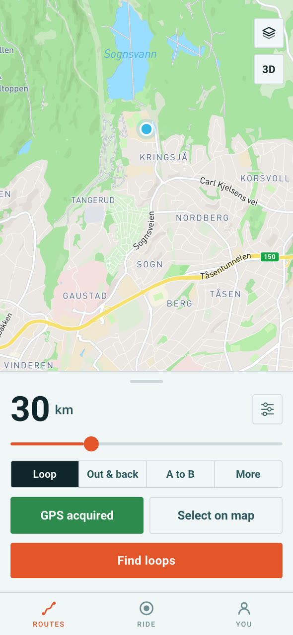
Linje's planner today: a map of Sognsvann with 30 km, Loop, Out and back, A to B and More, and Find loops

What changed

  • A record screen with a clock that keeps time through pauses, and a summary at the end: distance, climbing, speed and an estimate of power and calories.
  • Finding a route became a map with a planner over it, instead of a form.
  • Rides to a place: pick a DNT cabin and Linje plans the way there, with its photograph and whether anyone is there to serve you.
  • A to B, and the first places on the map: cabins, swimming spots, campsites, saunas and moose sightings.

Why

I wanted planning a ride to happen on a map, the way you think about where to go, and then to be able to ride the thing it planned.

How it went

  1. Recording a ride, and a summary at the end of it
  2. The planner moves onto the map, and rides go to cabins
  3. A to B, and photographs of the cabins
  4. Swimming spots, campsites, saunas and moose on the map
Tell me what you think

Tell me what you think

An idea for Linje, something on this list you would change, or something missing that would make you use it. I read every message.

Send me a message

Follow along by RSS: linje-route.com/updates.xml

Where are you riding next?

Linje builds the ride, then works out when to leave and which way round. Join the waitlist for early access.